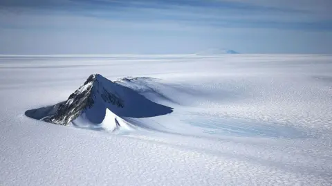
A new map has unmasked the landscape beneath Antarctica's ice in unprecedented detail, something scientists say could greatly enhance our understanding of the frozen white continent.
Researchers used satellite data and the physics of how Antarctica's glaciers move to work out what the continent might look like beneath the ice.
They found evidence of thousands of previously undiscovered hills and ridges, and say their maps of some of Antarctica's hidden mountain ranges are clearer than ever before.
While the maps are subject to uncertainties, the researchers believe the new details could shed light on how Antarctica will respond to climate change - and what that means for sea-level rise.
It's like before you had a grainy pixel film camera, and now you've got a properly zoomed-in digital image of what's really going on, lead author Dr Helen Ockenden, a researcher at the University of Grenoble-Alpes, said.
Thanks to satellites, scientists have a good understanding of Antarctica's icy surface – but what lies beneath has remained more of a mystery.
Researchers now have what they believe to be the most complete, detailed map of that underbelly ever made. Traditional measurements from the ground or air had left gaps in knowledge.
By combining satellite observations of the ice surface with physics about ice movement, scientists have discovered tens of thousands of new features beneath the ice.
This new mapping holds potential for improving future climate models concerning how Antarctica's ice will behave as global temperatures rise, a crucial aspect of forecasting related to sea-level changes.