In brief
A violent flood burst through the Nepal–China border on 26 August 2026, wiping out buildings, rivers and the Friendship Bridge. CCTV footage captured a wall of mud, water and debris in seconds, while satellite images confirmed the destruction of the border crossing. Immigration records show only 89 individuals officially cleared the border that morning, yet eyewitnesses estimate 2,000–2,500 people were caught in the deluge, with over 275 Indian nationals listed as missing. The disaster disrupted Nepal’s key trade artery and underscored the vulnerability of infrastructure in mountainous flood zones.
A flood of epic scale struck the Gyirong border at 10:52 Tibetan time, just minutes after Nepali immigration records closed for the day.
Video captured on the Chinese side showed a towering wall of mud, water and rock surge, terrifying travellers waiting to cross. The footage, timestamped to 10:59:53, visibly changed from a dark cloud to a full‑blown torrent in only a few seconds.
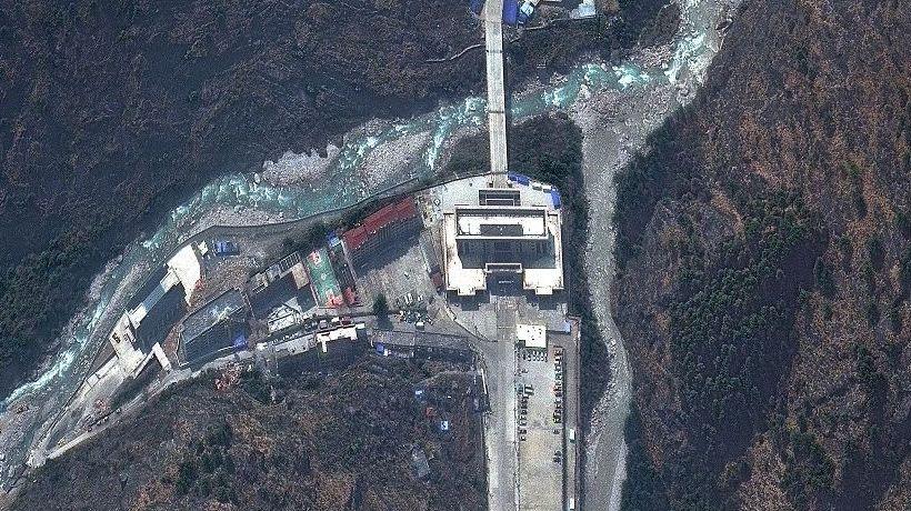
Satellite imagery of the area before the flood confirms the loss of dozens of buildings and vehicles. The Rasuwagadhi immigration office, 100 metres above the river, was flooded higher than recorded, sweeping away four staff members including the head of the office.
Imprisoned at an estimate of 2,000–2,500 people, the true toll could far exceed official counts. The remaining 275 Indian nationals in Nepal, according to their foreign ministry, have yet to be recovered. 89 individuals—mostly Indians—cleared Nepal’s borders that morning, but many were still on the ground when the flood hit.
The flooding destroyed the Friendship Bridge, roads and a hydropower substation, halting the flow of goods that once shipped 80% of Nepal’s electric‑vehicle imports from China. The border’s closure has forced traders to rely on the nearby Tatopani crossing, which is also threatened by landslides.
Experts say the area’s geology—steep gorges and fast waterways—makes it a hot spot for glacial collapses. In July 2025, a previous flood left the crossing closed for six months; it reopened only after China built a temporary bridge. Analysts now warn that Nepal should diversify its border points and rethink hydropower projects that sit on the same river systems.
Rescue teams on the Chinese side reported seeing only ruins. The incident has highlighted the urgent need for advanced monitoring and climate‑adaptive infrastructure in fragile mountain regions.