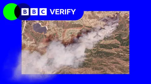
Satellite images have revealed the scale of two wildfires spreading in southern California.
The Sandy Fire ignited on Monday morning in the city of Simi Valley, north-west of Los Angeles, according to California Governor Gavin Newsom.
Satellite images taken just after noon local time show a large plume of smoke rising into the air just south of the city.
California fire officials reported on Tuesday morning that 750 firefighters are being supported by night-flying helicopters to target hotspots.
The Simi Valley Police Department noted that the fire was sparked when an individual hit a rock with a tractor.
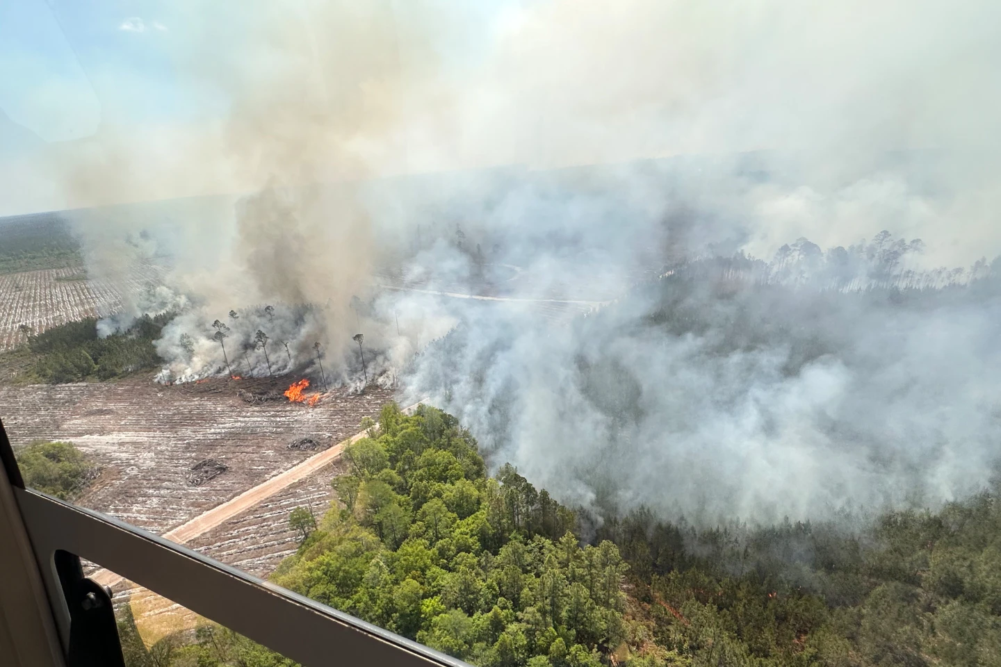
The blaze has spread across 1,364 acres (550 hectares), with no parts contained as of the report.
NASA's wildfire monitoring platform indicates that active hotspots have moved further south.
More than 10,000 homes have been evacuated from Simi Valley and surrounding communities, with an additional 3,500 homes under evacuation warnings extending into Los Angeles county.
Despite concerns, Los Angeles mayor Karen Bass stated that officials believe the blaze will not reach the city, issuing warnings out of caution.
The fire's expansion was aided by strong winds, which calmed later in the day.
Simi Valley schools announced closures for Tuesday due to the situation.
Earlier in January 2025, fires in the Los Angeles region claimed around 30 lives and destroyed over 10,000 homes.
Satellite imagery also shows another fire on Santa Rosa Island, affecting 14,600 acres of Channel Islands National Park, with ongoing efforts to manage the situation.
The US Coast Guard has rescued individuals from the island, while local wildlife faces potential ecological ramifications due to the fires' advances.